
This geography problem is solved step by step below, with detailed explanations to help you understand the method and arrive at the correct answer.
ScanSolve AI Answer
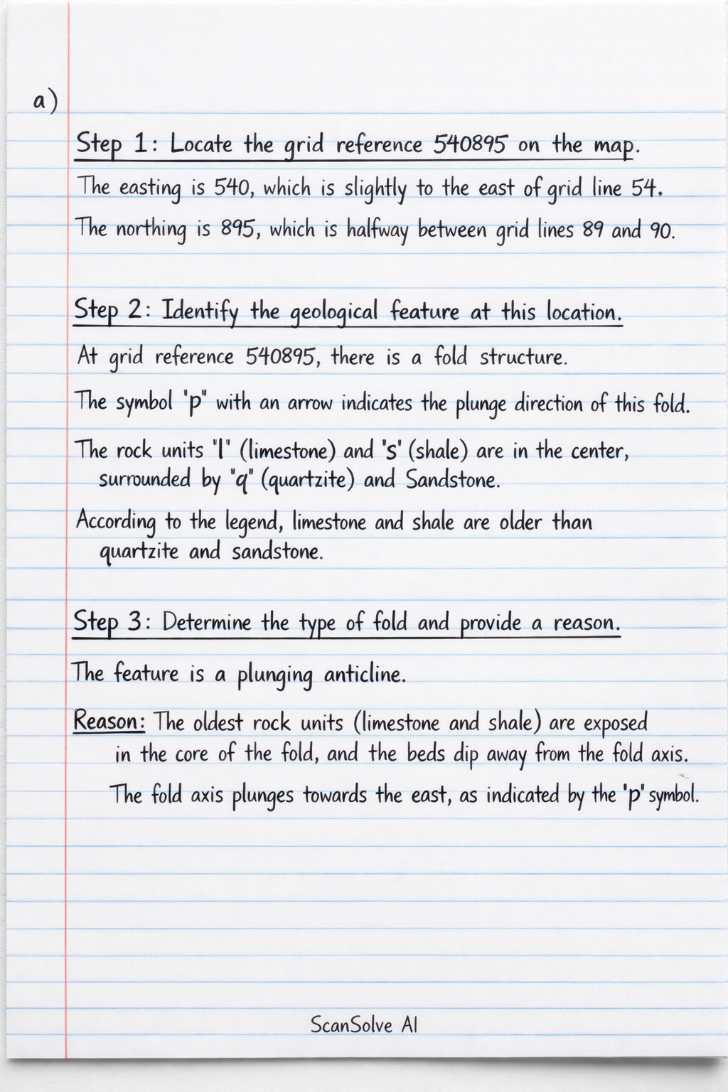
Hey Gobte — ready when you are. a) Step 1: Locate the grid reference 540895 on the map. The easting is 540, which is slightly to the east of grid line 54. The northing is 895, which is halfway between grid lines 89 and 90. Step 2: Identify the geological feature at this location. At grid reference 540895, there is a fold structure. The symbol 'p' with an arrow indicates the plunge direction of this fold. The rock units 'l' (limestone) and 's' (shale) are in the center, surrounded by 'q' (quartzite) and sandstone. According to the legend, limestone and shale are older than quartzite and sandstone. Step 3: Determine the type of fold and provide a reason. The feature is a plunging anticline. Reason: The oldest rock units (limestone and shale) are exposed in the core of the fold, and the beds dip away from the fold axis. The fold axis plunges towards the east, as indicated by the 'p' symbol. The feature located at grid reference 540895 is a: Plunging Anticline Reason: The oldest rock units (limestone and shale) are found in the core of the fold, and the fold axis plunges to the east. Send me the next one 📸