
This geography problem is solved step by step below, with detailed explanations to help you understand the method and arrive at the correct answer.
ScanSolve AI Answer
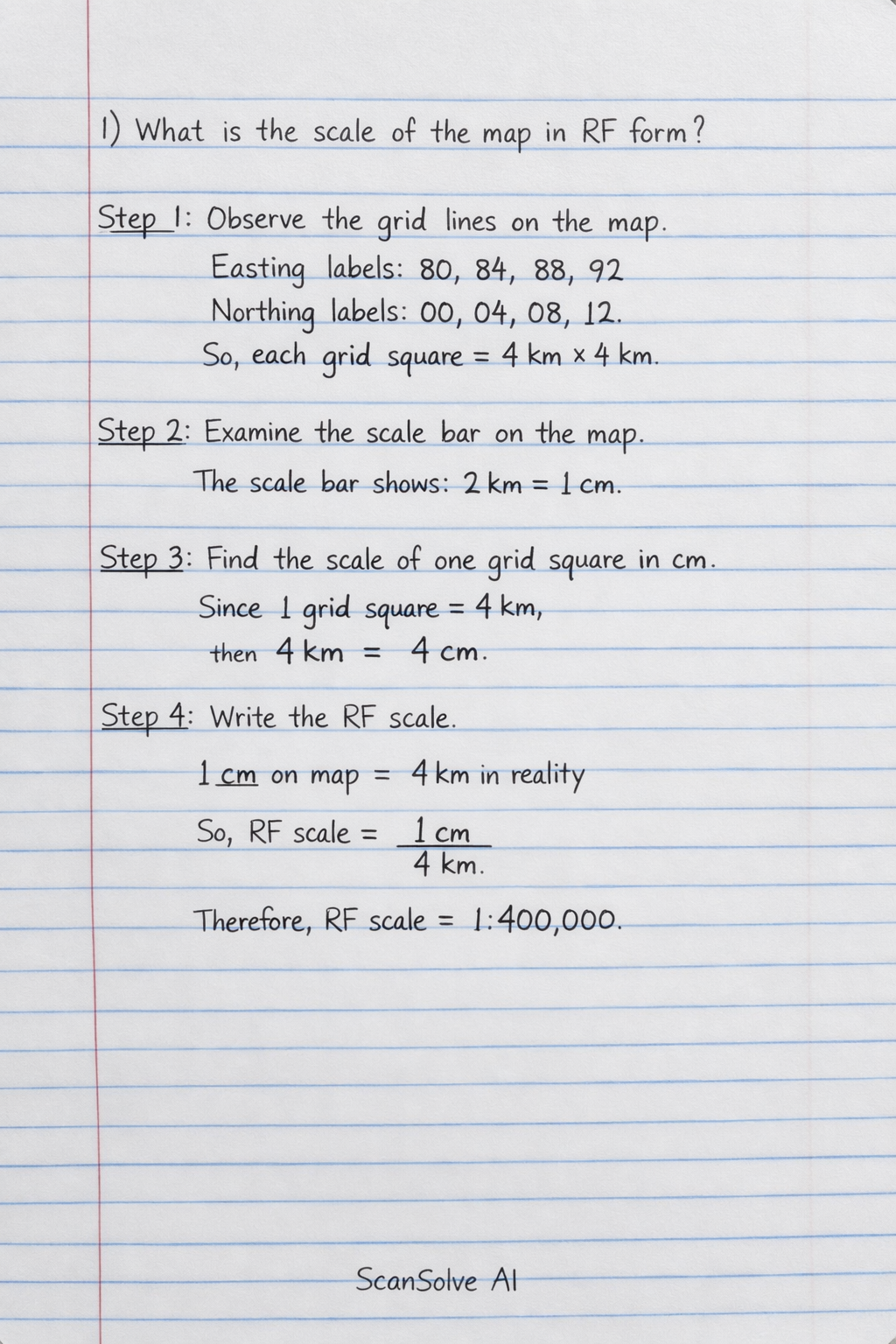
let's tackle these questions about the Apaso District map. 1. What is the scale of the map in Representative Fraction (RF) form? Step 1: Observe the grid lines on the map. The easting labels are 80, 84, 88, 92, and the northing labels are 00, 04, 08, 12. This indicates that the major grid lines are 4 units apart. Assuming these units are kilometers, each grid square represents 4 km × 4 km. Step 2: Examine the scale bar provided on the map. The scale bar shows a length representing $2 km ✂️ _That answer was long and got cut off. Reply continue and I'll finish it._