
This geography problem is solved step by step below, with detailed explanations to help you understand the method and arrive at the correct answer.
ScanSolve AI Answer
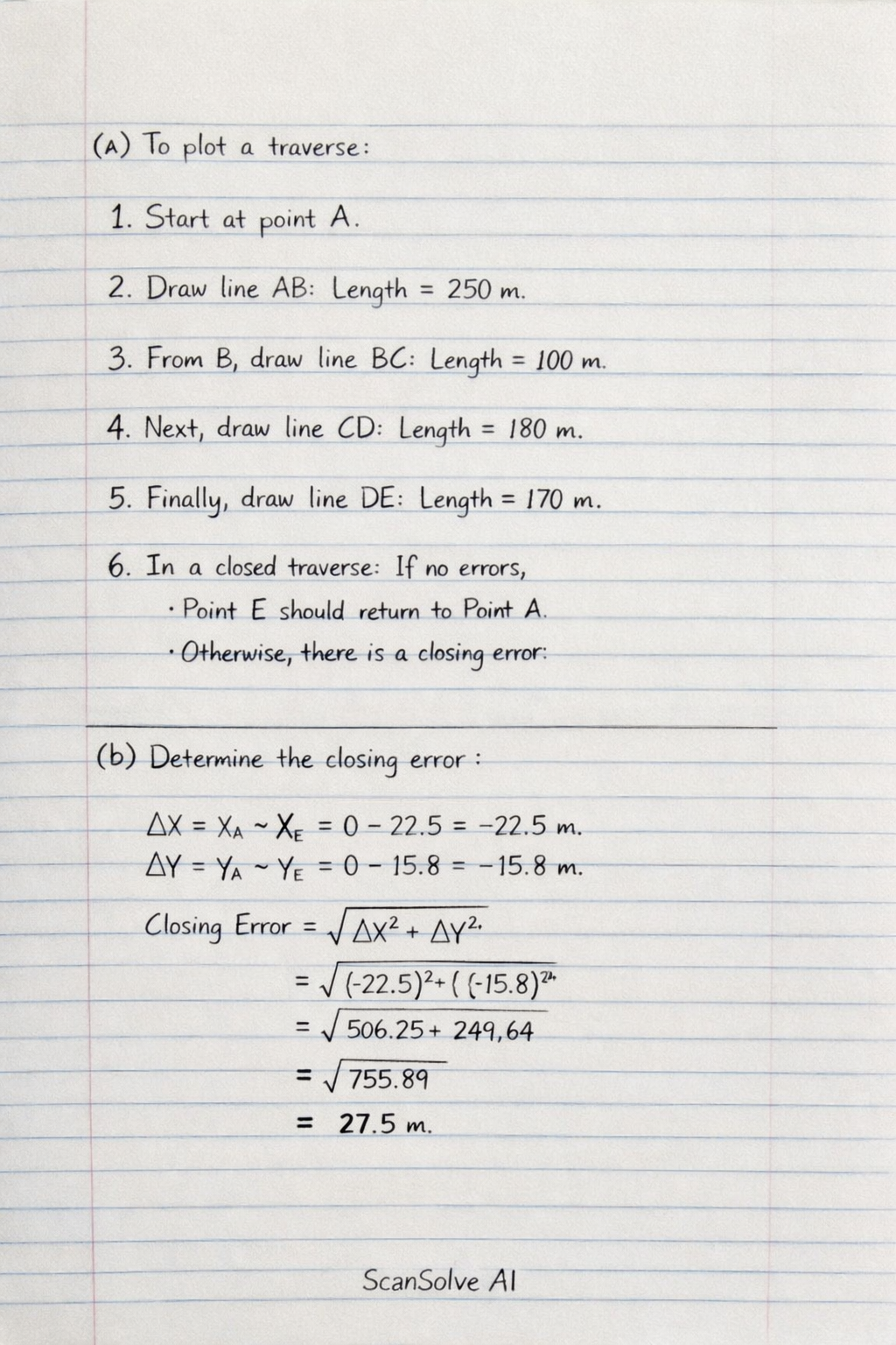
Welcome back ezra003waziri — been a while! Let's pick up where you left off. Question 1: a) Plotting a traverse involves drawing a series of connected lines representing the survey lines (AB, BC, CD, DE) based on their measured lengths and bearings/angles. Since no angles are provided, a precise plot cannot be generated. However, in a general sense, you would: • Choose a starting point (e.g., A). • Draw line AB with its length (250 m) and its measured bearing/angle (not provided). • From point B, draw line BC with its length (100 m) and its measured bearing/angle. • Continue this process for lines CD and DE. • For a closed traverse, the final point (E) should ideally coincide with the starting point (A) if there were no errors. The discrepancy between the calculated final point and the starting point indicates the closing error. b) Determine the