
We read your photo as:
A ship sails from port P on a bearing of N45°E for 15 km to port Q. It then sails on a bearing of S45°E for 20 km to port R. Draw a diagram to represent this journey and determine the bearing of R fro
Mathematics
ScanSolve AI Answer
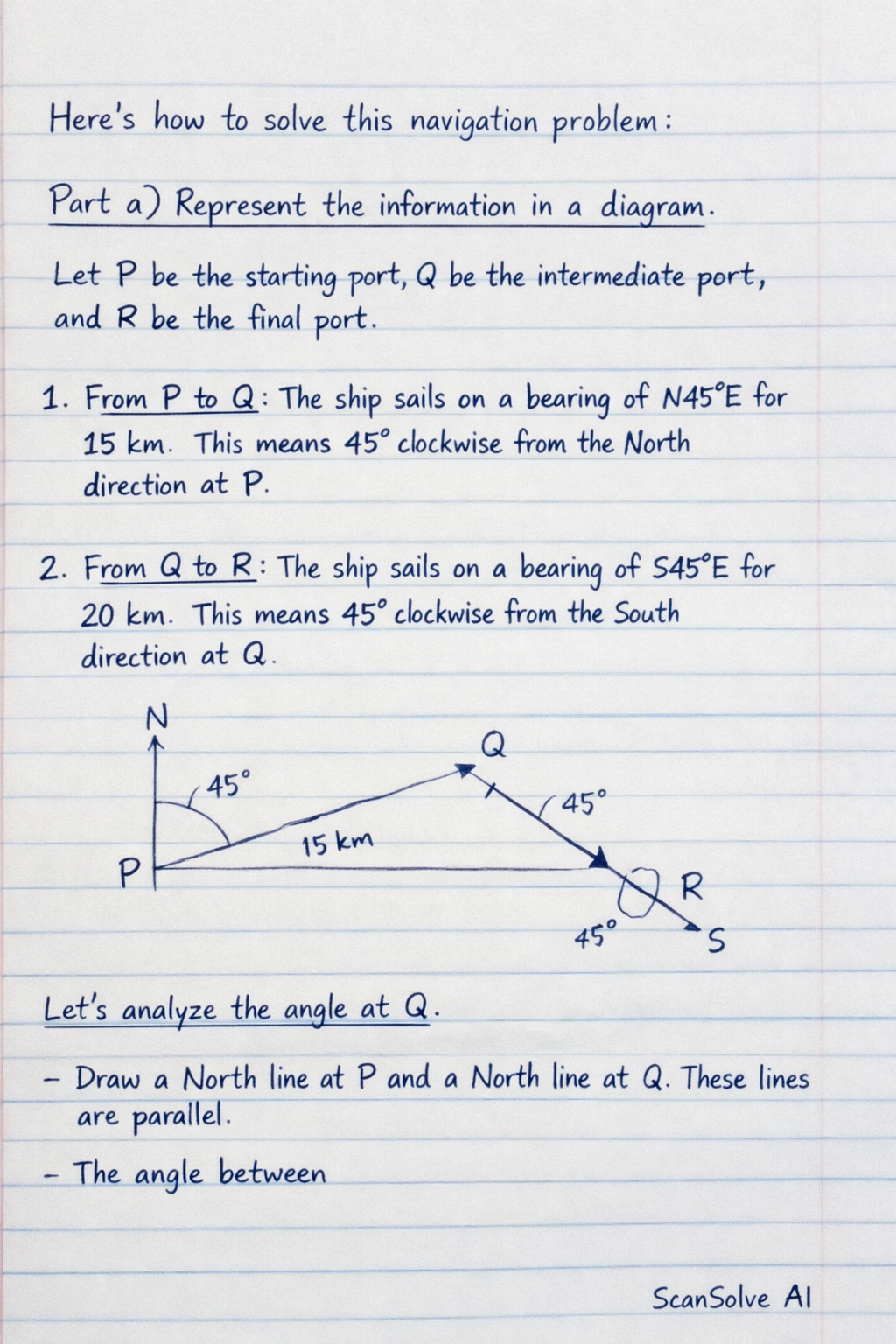
Here's how to solve this navigation problem:
Part a) Represent the information in a diagram.
Let P be the starting port, Q be the intermediate port, and R be the final port.
- From P to Q: The ship sails on a bearing of N45°E for 15 km. This means 45° clockwise from the North direction at P.
- From Q to R: The ship sails on a bearing of S45°E for 20 km. This means 45° clockwise from the South direction at Q.
Let's analyze the angle at Q.
- Draw a North line at P and a North line at Q. These lines are parallel.
- The angle between
Was this helpful?
Still stuck on this one?
Ask a follow-up, and the answer starts from this question.
Got a different question?Ask your own question
More Mathematics Questions
QA vessel sails from port P to a harbour H ,a distance of 75m on a bearing of 308 degree it then…QA boat sails 160km from a harbour P on a bearing of 036° 60'. Q and then 200 km on a bearing of 125°…QA ship sails from Port A on a bearing 065° to Port B a distance 54 km. It then sails on the bearing…QA ship sails from P to Q, then to R. The bearing of Q from P is 035°. The bearing of R from Q is…QA ship sails from port A to port B, 30 km away on a bearing of 060^. It then sails to port C, 40 km…
Browse by topic:Trigonometry
Handwritten Step-by-Step Solution
Get this as a handwritten image on WhatsApp — like a tutor wrote it for you.
Try on WhatsApp