
This economics question tests your understanding of economic models and analysis. The step-by-step answer below applies the relevant framework and explains the reasoning.
ScanSolve AI Answer
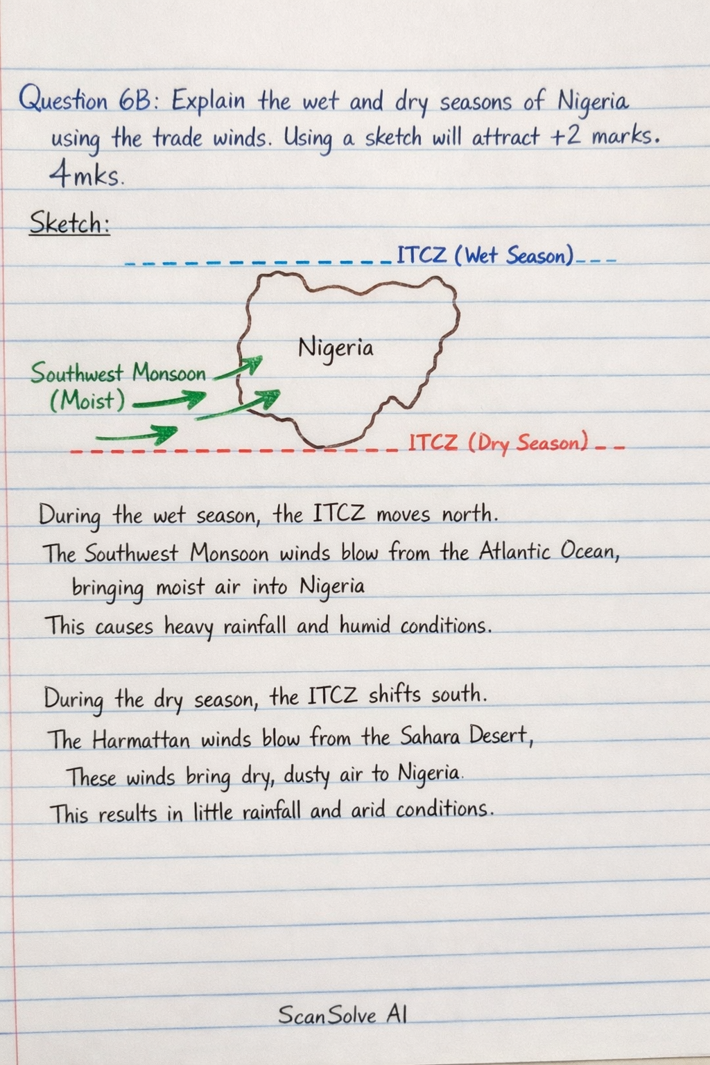
Question 6B: Explain the wet and dry seasons of Nigeria using the trade winds. Using a sketch will attract +2 marks. 4mks Sketch: [scale=0.8] % Nigeria representation (simplified) [thick, brown] (-1,0) -- (1,0) -- (1.5,1.5) -- (0,2) -- (-1.5,1.5) -- cycle; at (0,1) Nigeria; % ITCZ (Wet Season - North) [dashed, blue, thick] (-2,2.5) -- (2,2.5); [blue] at (2.5,2.5) ITCZ (Wet Season); % Southwest Monsoon (Wet Season) [->, thick, green] (-3,-0.5) -- (-1.5,0.5); [->, thick, green] (-2.5,0) -- (-1,1); [green] at (-3.5,0) Southwest Monsoon (Moist); % ITCZ (Dry Season - South) [dashed, red, thick] (-2,-1.5) -- (2,-1.5); [red] at (2.5,-1.5) ITCZ (Dry Season); % Northeast Trade Winds (Dry Season) [->, thick, orange] (3,2) -- (1.5,1); [->, thick, orange] (2.5,1.5) -- (1,0.5); [orange] at (3.5,2) Northeast Trade Winds (Dry/Harmattan); % Labels for seasons at (0,3) Wet Season (June-Sept); at (0,-2.5) Dry Season (Nov-March); Explanation: Nigeria's wet and dry seasons are primarily governed by the seasonal migration of the Intertropical Convergence Zone (ITCZ) and the associated trade winds. During the wet season (roughly June to September), the ITCZ moves northward, bringing the moist Southwest Monsoon winds from the Atlantic Ocean over Nigeria, resulting in heavy rainfall. During the dry season (roughly November to March), the ITCZ shifts southward, allowing the dry, dusty Northeast Trade Winds* (known as Harmattan) from the Sahara Desert to dominate, leading to arid conditions and cooler temperatures. Question 6C: The Gulf Stream plays a significant role in global weather pattern between the tropics and temperate world. How? 4mks The Gulf Stream is a powerful, warm ocean current that transports vast amounts of heat from the tropical Atlantic towards the North Atlantic and Western Europe. This warm water releases heat into the atmosphere, significantly moderating the climate of Western Europe, making it much warmer and wetter than other regions at similar latitudes. It also influences atmospheric pressure systems and contributes to the global distribution of heat, impacting weather patterns far beyond its immediate path.