
This geography problem is solved step by step below, with detailed explanations to help you understand the method and arrive at the correct answer.
ScanSolve AI Answer
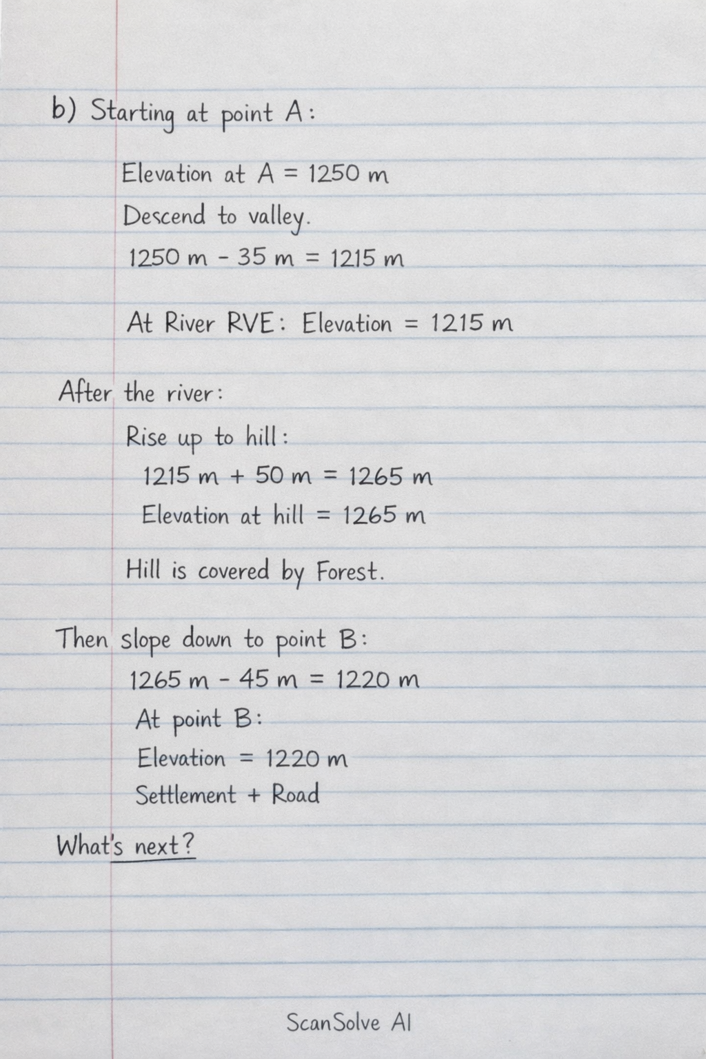
b) A sketch section along line AB would illustrate the following: • Starting at point A (approximately 1250m), the land descends steeply to a valley where the River RVE flows (below 1220m). • After the river, the land rises steeply to a hill (reaching above 1260m) covered by Forest. • The land then gently slopes downwards towards point B (approximately 1220m), where a Settlement and a Road are located. What's next?