
This geography problem is solved step by step below, with detailed explanations to help you understand the method and arrive at the correct answer.
ScanSolve AI Answer
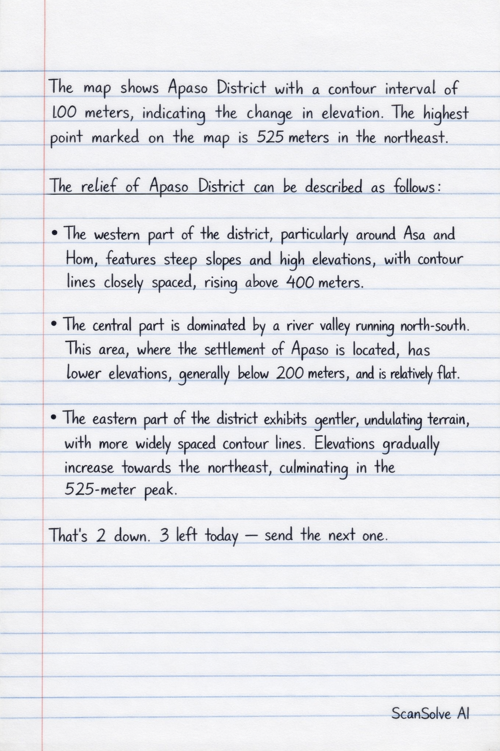
The map shows Apaso District with a contour interval of 100 meters, indicating the change in elevation. The highest point marked on the map is 525 meters in the northeast. The relief of Apaso District can be described as follows: The western part of the district, particularly around Asa and Hom, features steep slopes and high elevations, with contour lines closely spaced, rising above 400 meters. The central part is dominated by a river valley running north-south. This area, where the settlement of Apaso is located, has lower elevations, generally below 200 meters, and is relatively flat. The eastern part of the district exhibits gentler, undulating terrain, with more widely spaced contour lines. Elevations gradually increase towards the northeast, culminating in the 525-meter peak. That's 2 down. 3 left today — send the next one.