
This geography problem is solved step by step below, with detailed explanations to help you understand the method and arrive at the correct answer.
ScanSolve AI Answer
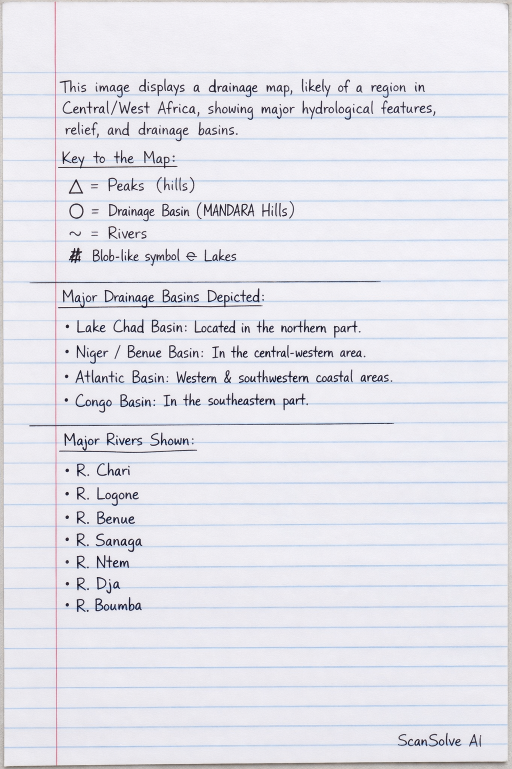
This image displays a drainage map, likely of a region in Central/West Africa, showing major hydrological features, relief, and drainage basins. Key to the Map: : Represents Peaks* (or hills). : Denotes a specific Drainage Basin* (labeled as MANDARA Hills). : Represents Rivers*. A blob-like symbol with squiggly lines: Represents Lakes*. Major Drainage Basins Depicted: Lake Chad Basin: Located in the northern part of the map. Niger or Benue Basin: Situated in the central-western part. Atlantic Basin: Covers the western and southwestern coastal areas, draining into the Atlantic Ocean. Congo Basin: Indicated in the southeastern part, suggesting drainage towards the Congo River system. Major Rivers Shown: R. Chari R. Logone R. Benue R. Sanaga R. Ntem R. Dja R. Boumba Major Physical Features and Relief: Western Highlands: A mountainous or elevated region in the west, marked by several peaks (). Adamawa Plateau: A significant plateau located centrally. South Cameroon Low Plateau: A lower elevation plateau in the southern part. Mandara Hills: Mentioned in the key as a drainage basin, implying a hilly region. Mt. Fako: A specific peak () located in the southwestern part, near the Atlantic Basin. External Water Bodies: Atlantic Ocean: The major ocean body bordering the western and southwestern coastlines, receiving drainage from the Atlantic Basin.