
log out INCOMPARABLE SCHOOLS Free Ebook Download TOWOLAWI MALEEK OPEMIPO: SS 3 LAST SEEN IN SCHOOL UNAVAILABLE INFORMATION FROM THE SCHOOL. Select subjects INCOMPARABLE SCHOOLS CBT GEOGRAPHY 2ND TERM ->2026 Duration:45min Test Mode warning if you do not submit your answers before time runs out, you will score zero. To check your score, click Statistics. 1. Which of the following represents the correct sequence in which denudation occurs A. Weathering, erosion and deposition B. Erosion, weathering and deposition C. Weathering, deposition and erosion D. Deposition,erosion and weathering A 2. Which drainage pattern is best formed in areas of alternate hard and soft rocks A. Trellised B. Dendritic C. Radial D. Annular Ans 3. Rocks formed through concentration of accumulated materials under water is A. Metamorphic B. Igneous C. Sedimentary D. Acidic Ans 4. An intrusion of thick acid lava which forces overlying sedimentary rock layers to bulge into a dome may cool and solidify to form a A. batholith B. lacolith C. dyke D. lopolith Ans 5. The Greek system of classifying Climate is based on A. Temperature B. Rainfall and temperature C. Rainfall and vegetation D. Humidity Ans 6. What will be the time at Greenwich meridian when it is 12 noon at longitude 60°E A. 4am B. 4pm C. 8am D. 8pm Ans 7. The movement of the earth around the sun on its elliptical orbit is called A. rotation B. axis C. revolution D. gravitation Ans 8. The Deccan Plateau in India is a good example of A. Dissected plateau B. Volcanic Plateau C. Tectonic Plateau D. Intermontane Plateau Ans 9. Horst is a feature associated with A. Volcanic mountain B. Residual mountain C. Block mountain D. Fold mountain Ans 10. Which of the following pair of land forms are surface features of Karst region 1 Clint 2 Grikes 3 Stalagmites 4 Caven A. 1 and 2 only B. 1 and 3 only C. 2 and 3 only D. 2 and 4 only Ans 11. Two towns, A and B are on the international dateline, what would be the distance between the two towns if town A is located on latitude 40°N and town B is located on latitude 10°N A. 8880 Km B. 5550 Km C. 3330 Km D. 2220 Km Ans 12. Wind erosion results in the formation of the following landforms except A. Zeugen B. Yardang C. Ventifact D. Barchan Ans 13. Which of the following best explains the breaking down of well jointed rocks into large rectangular shaped features by mechanical weathering A. Block disintegration B. Exfoliation dome C.Landslide D. Solufluctation Ans 14. Which of the following conditions can produce a water fall A. Sharp break in the bed of a river B. Elbow of capture of young river C. Backward erosion D. Lateral erosion Ans 15. Which of the following sequence is correct in the formation of a stack A. Cave, arch, headland,stack B. Headland, Cave,arch,stack C. Headland, arch, cave,stack D. Cave, Headland,arch, stack Ans 16. In which of the following regions will weathering by frost action occur throughout the year A. Cool temperature B. Equatorial C. Monsoon D. Mediterranean Ans 17. Which of the following is a proof of the Earth's spherical shape A. Circum navigation B. Variations in the length of the day and night C. Marking of a year D. Rise and fall of tides Ans 18. Which of the following types of rocks contain fossils A. Igneous B. Sedimentary C. Metamorphic D. Volcanic Ans 19. The natural exchange of water between land, oceans and the atmosphere is known as the A. Energy Cycle B. Hydrological cycle C. Nitrogen Cycle D Carbon Cycle Ans 20. Lines drawn on maps connecting places with equal duration of sunshine are called A. isohels B. Isotherms C. Isonephs D. Isohyets Ans THEORY Answer all 1a. Differentiate between Primary and a secondary industries b. Outline four reasons for the predominance of light industries in developing countries c. Highlight four contributions of the industrial sector to the economic development of the developing countries 2a. State four migration patterns b. Explain four factors that can trigger population movement in Tropical Af
ScanSolve AI Answer
Here are the solutions to the Geography questions.
Multiple Choice Questions
-
The correct sequence in which denudation occurs is:
- A. Weathering, erosion and deposition
-
The drainage pattern best formed in areas of alternate hard and soft rocks is:
- A. Trellised
-
Rocks formed through concentration of accumulated materials under water are:
- C. Sedimentary
-
An intrusion of thick acid lava which forces overlying sedimentary rock layers to bulge into a dome may cool and solidify to form a:
- B. Laccolith
-
The Greek system of classifying Climate is based on:
- B. Rainfall and temperature
-
What will be the time at Greenwich meridian when it is 12 noon at longitude 60°E:
- C. 8am
- Explanation: The difference in longitude is . Since of longitude corresponds to 4 minutes, the time difference is minutes, or 4 hours. Greenwich (0° longitude) is west of 60°E, so the time will be earlier. .
-
The movement of the earth around the sun on its elliptical orbit is called:
- C. Revolution
-
The Deccan Plateau in India is a good example of:
- B. Volcanic Plateau
-
Horst is a feature associated with:
- C. Block mountain
-
The pair of landforms that are surface features of Karst region are:
- A. 1 and 2 only (Clint and Grikes)
-
Two towns, A and B are on the international dateline, what would be the distance between the two towns if town A is located on latitude 40°N and town B is located on latitude 10°N:
- C. 3330 Km
- Explanation: The difference in latitude is . Each degree of latitude is approximately 111 km. So, the distance is .
-
Wind erosion results in the formation of the following landforms except:
- D. Barchan (Barchans are formed by wind deposition).
-
The breaking down of well jointed rocks into large rectangular shaped features by mechanical weathering is best explained by:
- A. Block disintegration
-
Which of the following conditions can produce a water fall:
- A. Sharp break in the bed of a river
-
Which of the following sequence is correct in the formation of a stack:
- B. Headland, Cave, arch, stack
-
In which of the following regions will weathering by frost action occur throughout the year:
- A. Cool temperature (While not strictly year-round daily, cool temperate regions experience significant and frequent frost action, especially in winter and shoulder seasons, more so than other options).
-
Which of the following is a proof of the Earth's spherical shape:
Still stuck on this one?
Ask a follow-up, and the answer starts from this question.
More Law Questions
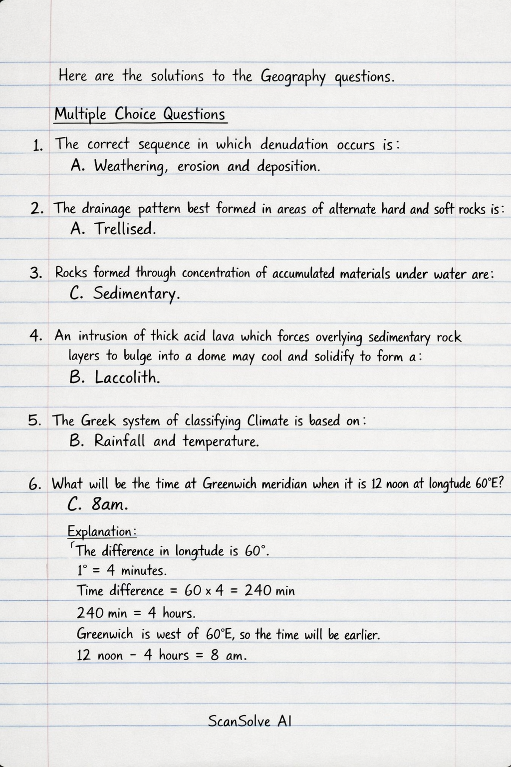
Handwritten Step-by-Step Solution
Get this as a handwritten image on WhatsApp — like a tutor wrote it for you.
Try on WhatsApp