
We read your photo as:
(A) Label the diagram of layers of earth given below. (B) Mention extent of each layer in kilometers.
Geography
ScanSolve AI Answer
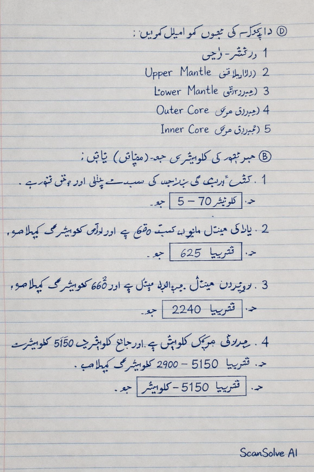
زمین کئی تہوں پر مشتمل ہے، جن میں سے ہر ایک کی اپنی خصوصیات اور گہرائی ہے۔ دی گئی تصویر میں زمین کی تہوں کو دکھایا گیا ہے، اور ان کی گہرائی کلومیٹر میں درج ذیل ہے:
A) ڈایاگرام کی تہوں کو لیبل کریں:
- Crust (قشر ارض)
- Upper Mantle (بالائی مینٹل)
- Lower Mantle (زیریں مینٹل)
- Outer Core (بیرونی مرکز)
- Inner Core (اندرونی مرکز)
B) ہر تہہ کی کلومیٹر میں حد (موٹائی) بتائیں:
- Crust (قشر ارض): یہ زمین کی سب سے بیرونی اور پتلی تہہ ہے۔ اس کی موٹائی سمندروں کے نیچے تقریباً 5 کلومیٹر سے لے کر براعظموں کے نیچے 70 کلومیٹر تک مختلف ہوتی ہے۔
- حد:
- Upper Mantle (بالائی مینٹل): یہ قشر ارض کے نیچے واقع ہے اور تقریباً 660 کلومیٹر کی گہرائی تک پھیلا ہوا ہے۔
- حد:
- Lower Mantle (زیریں مینٹل): یہ بالائی مینٹل کے نیچے ہے اور تقریباً 660 کلومیٹر سے 2900 کلومیٹر کی گہرائی تک پھیلا ہوا ہے۔
- حد:
- Outer Core (بیرونی مرکز): یہ مائع حالت میں ہے اور تقریباً 2900 کلومیٹر سے 5150 کلومیٹر کی گہرائی تک پھیلا ہوا ہے۔
- حد:
- Inner Core (اندرونی مرکز): یہ زمین کا سب سے اندرونی اور ٹھوس حصہ ہے، جو تقریباً 5150 کلومیٹر سے زمین کے مرکز (تقریباً 6371 کلومیٹر) تک پھیلا ہوا ہے۔
- حد:
Was this helpful?
Still stuck on this one?
Ask a follow-up, and the answer starts from this question.
Got a different question?Ask your own question
More Geography Questions
QIdentify and describe the different layers of the Earth based on the provided diagram and questions.QDescribe and diagram the layers of the Earth based on their relative thickness and physical state.QIdentify the Earth's layers based on the following descriptions and their corresponding letter…QDescribe the layers of the Earth, including their composition, density, and physical state.QA diagram shows a soil profile with labels I, II, III, IV representing different horizons. Answer…
Handwritten Step-by-Step Solution
Get this as a handwritten image on WhatsApp — like a tutor wrote it for you.
Try on WhatsApp