
This geography problem is solved step by step below, with detailed explanations to help you understand the method and arrive at the correct answer.
ScanSolve AI Answer
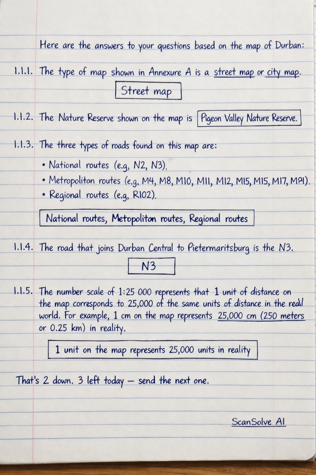
Here are the answers to your questions based on the map of Durban: 1.1.1. The type of map shown in Annexure A is a street map or city map. Street map 1.1.2. The Nature Reserve shown on the map is Pigeon Valley Nature Reserve. Pigeon Valley Nature Reserve 1.1.3. The three types of roads found on this map are: • National routes (e.g., N2, N3) • Metropolitan routes (e.g., M4, M8, M10, M11, M12, M13, M15, M17, M19, M21) • Regional routes (e.g., R102) National routes, Metropolitan routes, Regional routes 1.1.4. The road that joins Durban Central to Pietermaritzburg is the N3. N3 1.1.5. The number scale of 1:25\,000 represents that 1 unit of distance on the map corresponds to 25\,000 of the same units of distance in the real world. For example, 1 cm on the map represents 25\,000 cm (250 meters or 0.25 km) in reality. 1 unit on the map represents 25,000 units in reality That's 2 down. 3 left today — send the next one.