
This geography problem is solved step by step below, with detailed explanations to help you understand the method and arrive at the correct answer.
ScanSolve AI Answer
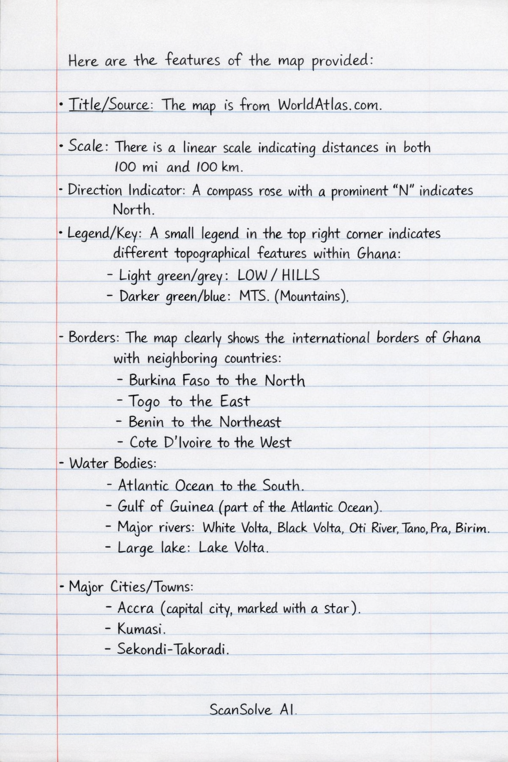
Here are the features of the map provided: Title/Source: The map is from WorldAtlas.com*. Scale: There is a linear scale indicating distances in both miles (100 mi) and kilometers (100 km)*. Direction Indicator: A compass rose* with a prominent 'N' indicates North. Legend/Key: A small legend in the top right corner indicates different topographical features* within Ghana: Light green/grey: LOW/HILLS* Darker green/blue: MTS. (Mountains)* Borders: The map clearly shows the international borders* of Ghana with neighboring countries: Burkina Faso* to the North Togo* to the East Benin* to the Northeast Cote D'Ivoire* to the West Water Bodies: Atlantic Ocean* to the South. Gulf of Guinea* (part of the Atlantic Ocean). Major rivers: White Volta, Black Volta, Oti River, Tano, Pra, Birim*. Large lake: Lake Volta*. Major Cities/Towns: Accra* (capital city, marked with a star). Kumasi*. Sekondi-Takoradi*. Tamale*. Bolgatanga*. Ho*. Tema*. Sunyani*. Tumu*. Bimbilla*. Asamankese*. Tarkwa*. Neighboring cities: Lomé (Togo), Abidjan* (Cote D'Ivoire). National Parks: Mole Nat. Park*. Bui Nat. Park*. Digya Nat. Park*. Kakum N.P.* Mountains: Mt. Afadjato* is indicated. Country Name: Ghana* is prominently displayed in red.