
This geography problem is solved step by step below, with detailed explanations to help you understand the method and arrive at the correct answer.
ScanSolve AI Answer
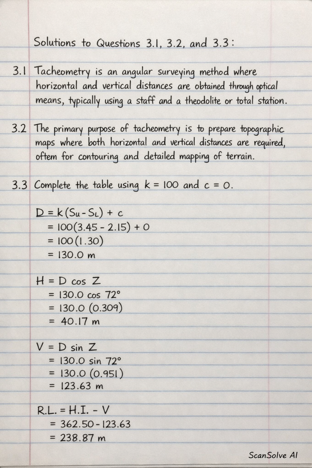
Here are the solutions to questions 3.1, 3.2, and 3.3. 3.1 Tacheometry is an angular surveying method where horizontal and vertical distances are obtained through optical means, typically using a staff and a theodolite or total station. 3.2 The primary purpose of tacheometry is to prepare topographic maps where both horizontal and vertical distances are required, often for contouring and detailed mapping of terrain. 3.3 To complete the table, we will use the following tacheometry formulas, assuming a multiplying constant k=100 and an additive constant c=0. The "Vert" angle is assumed to be the zenith angle Z. The "Stadia" column provides the upper and lower stadia