
This physics problem tests your understanding of fundamental physical laws and their applications. The step-by-step solution below breaks down the problem using relevant equations and physical reasoning.
ScanSolve AI Answer
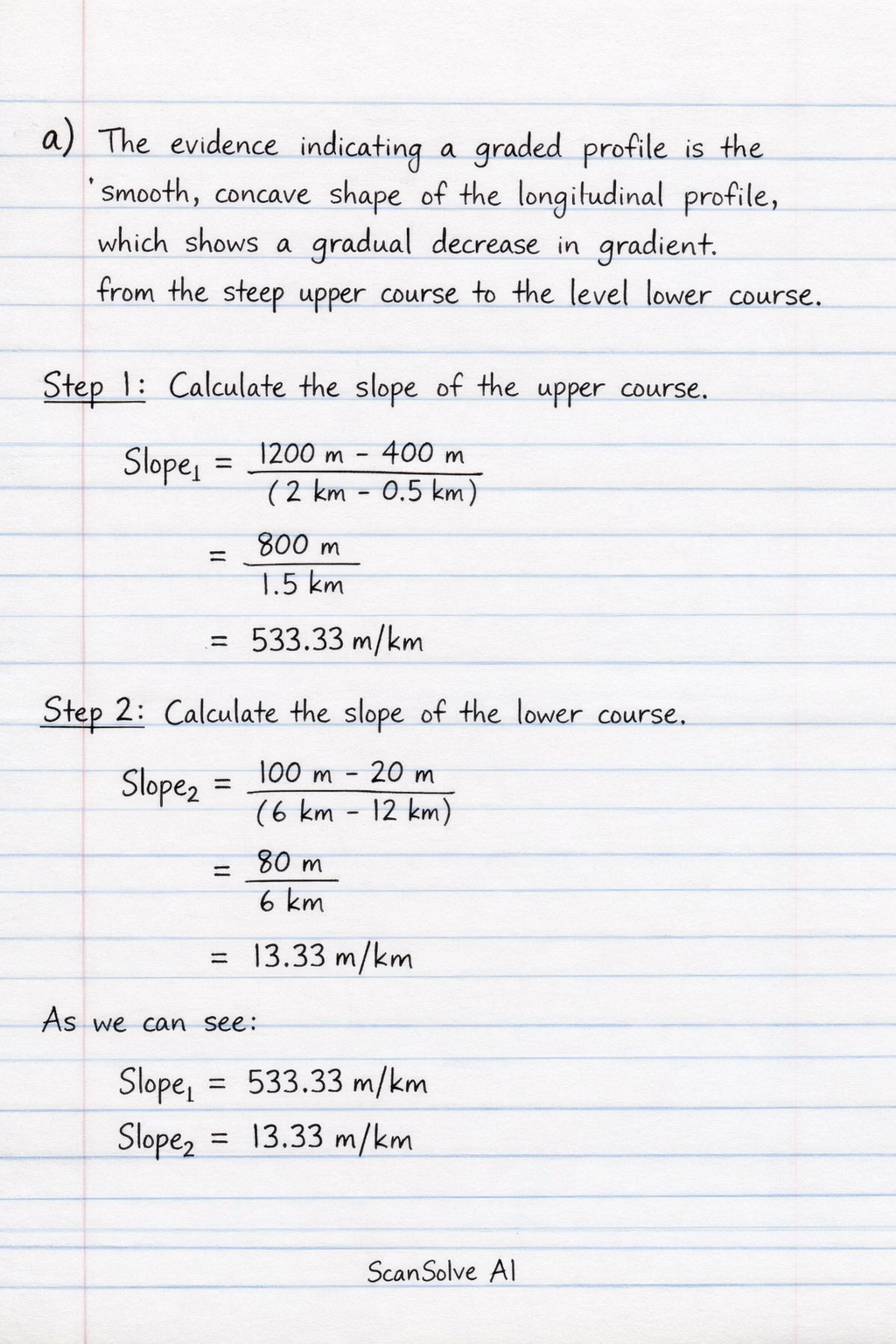
a) The evidence indicating a graded profile is the smooth, concave shape of the longitudinal profile, which shows a gradual decrease in gradient from the steep upper course to the level lower course. b) A river maintains its graded longitudinal profile through dynamic equilibrium, a balance between erosion and deposition. In the upper course (erosion zone), the steep gradient provides high energy for vertical erosion, transporting sediment downstream. As the river flows into the transition zone, the gradient lessens, and the river's energy is still sufficient to transport its sediment load. In the lower course (deposition zone), the gradient becomes very gentle, reducing velocity and causing deposition of sediment. If erosion temporarily exceeds deposition, the river deepens its channel, which reduces its gradient and thus its erosive power. Conversely, if deposition exceeds erosion, the river builds up its bed, increasing its gradient and restoring its transport capacity. These continuous adjustments ensure the river's energy is just enough to transport the sediment supplied to it, maintaining the smooth, concave profile over time. Send me the next one 📸