
This geography problem is solved step by step below, with detailed explanations to help you understand the method and arrive at the correct answer.
ScanSolve AI Answer
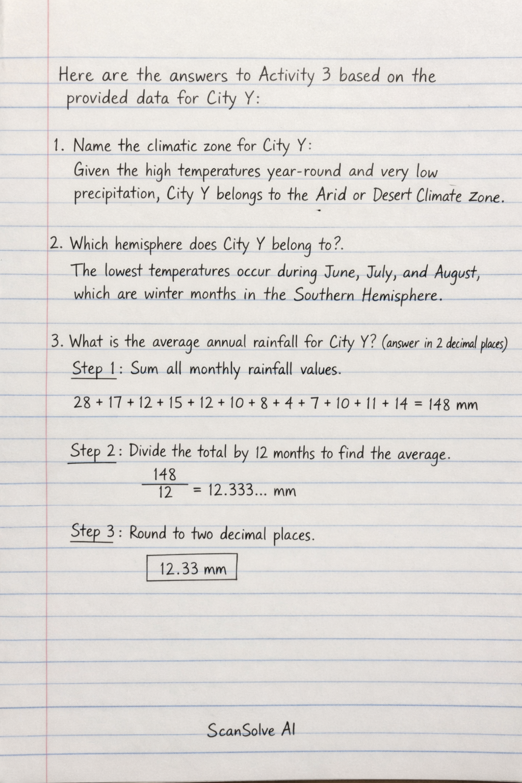
Here are the answers to Activity 3 based on the provided data for City Y: 1. Name the climatic zone for City Y: Given the high temperatures year-round and very low precipitation, City Y belongs to the Arid or Desert Climate Zone. 2. Which hemisphere does City Y belong to? The lowest temperatures occur during June, July, and August, which are winter months in the Southern Hemisphere. 3. What is the average annual rainfall for City Y? (answer in 2 decimal place) Step 1: Sum all monthly rainfall values. 28 + 17 + 12 + 15 + 12 + 10 + 8 + 4 + 7 + 10 + 11 + 14 = 148 mm Step 2: Divide the total by 12 months to find the average. (148)/(12) = 12.333... mm Step 3: Round to two decimal places. 12.33 mm 4. What is the average annual temperature for City Y? (answer in 2 decimal place) Step 1: Sum all monthly temperature values. 30 + 29 + 26.5 + 22 + 16.5 + 12.5 + 13 + 15.5 + 21 + 24.5 + 27 + 28.5 = 246^ Step 2: Divide the total by 12 months to find the average. (246)/(12) = 20.5^ Step 3: Express in two decimal places. 20.50^ 5. Explain, what happens in January in terms of temperature/precipitation; In January, City Y experiences its highest annual temperature at 30^ and its highest monthly precipitation at 28 mm. This indicates a hot and relatively wet (for an arid climate) summer month. That's 2 down. 3 left today — send the next one.