
This geography problem is solved step by step below, with detailed explanations to help you understand the method and arrive at the correct answer.
ScanSolve AI Answer
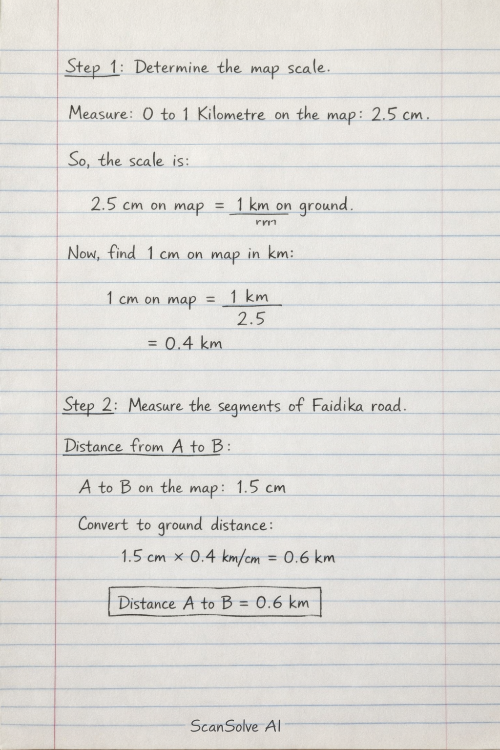
You're on a roll — The questions for Activity 4 are not visible in the image. However, based on the map (Figure 8) and typical map exercises, I will calculate the distances along Faidika road between the labeled points. Step 1: Determine the map scale. From the scale bar, 1 Kilometre on the ground corresponds to a certain length on the map. Measuring the segment from 0 to 1 Kilometre on the map, it is approximately 2.5 cm. So, the scale is: 2.5 cm on map = 1 km on ground To find out how many kilometres 1 cm on the map represents: 1 cm on map = 1 km2.5 = 0.4 km Step 2: Measure the length of each segment of Faidika road on the map and convert to ground distance. Distance from A to B: Measuring the segment A to B on the map, it is approximately 1.5 cm. Ground distance A to B = 1.5 cm × 0.4 km/cm = 0.6 km Distance from B to C: Measuring the segment B to C on the map, it is approximately 1.5 cm. Ground distance B to C = 1.5 cm × 0.4 km/cm = 0.6 km Distance from C to D: Measuring the segment C to D on the map, it is approximately 2.0 cm. Ground distance C to D = 2.0 cm × 0.4 km/cm = 0.8 km Distance from D to E: Measuring the segment D to E on the map, it is approximately 1.5 cm. Ground distance D to E = 1.5 cm × 0.4 km/cm = 0.6 km Total distance from A to E along Faidika road: Total map distance A to E = 1.5 cm + 1.5 cm + 2.0 cm + 1.5 cm = 6.5 cm Total ground distance A to E = 6.5 cm × 0.4 km/cm = 2.6 km Send me the next one 📸